


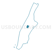
Voting District 6700118, New York County, New York
About
Outline

Summary
| Unique Area Identifier | 631840 |
| Name | Voting District 6700118 |
| County | New York County |
| State | New York |
| Area (square miles) | 0.39 |
| Land Area (square miles) | 0.34 |
| Water Area (square miles) | 0.05 |
| % of Land Area | 88.26 |
| % of Water Area | 11.74 |
| Latitude of the Internal Point | 40.77655740 |
| Longtitude of the Internal Point | -73.97017360 |
Maps

Graphs
Select a template below for downloading or customizing gragh for Voting District 6700118, New York County, New York


Neighbors
Neighoring Voting District (by Name) Neighboring Voting District on the Map
- Voting District 6700040 6700041, New York County, NY
- Voting District 6700042 6700043, New York County, NY
- Voting District 6700050, New York County, NY
- Voting District 6700051, New York County, NY
- Voting District 6700059, New York County, NY
- Voting District 6700060, New York County, NY
- Voting District 6700077 6700078, New York County, NY
- Voting District 6700079, New York County, NY
- Voting District 6700080, New York County, NY
- Voting District 6700083, New York County, NY
- Voting District 6700117, New York County, NY
- Voting District 6900001, New York County, NY
- Voting District 6900002, New York County, NY
- Voting District 6900107, New York County, NY
- Voting District 7300050, New York County, NY
- Voting District 7300058, New York County, NY
- Voting District 7300060, New York County, NY
- Voting District 7300062, New York County, NY
- Voting District 7300072, New York County, NY
- Voting District 7300074, New York County, NY
- Voting District 7300080, New York County, NY
- Voting District 7300081, New York County, NY
- Voting District 7300087, New York County, NY
- Voting District 7500128, New York County, NY
Top 10 Neighboring County Subdivision (by Population) Neighboring County Subdivision on the Map
Top 10 Neighboring Place (by Population) Neighboring Place on the Map
Top 10 Neighboring Unified School District (by Population) Neighboring Unified School District on the Map
Top 10 Neighboring State Legislative District Lower Chamber (by Population) Neighboring State Legislative District Lower Chamber on the Map
- Assembly District 75, NY (149,377)
- Assembly District 67, NY (134,810)
- Assembly District 73, NY (129,766)
- Assembly District 69, NY (127,919)
Top 10 Neighboring State Legislative District Upper Chamber (by Population) Neighboring State Legislative District Upper Chamber on the Map
- State Senate District 29, NY (333,345)
- State Senate District 26, NY (325,280)
- State Senate District 30, NY (318,569)
Top 10 Neighboring 111th Congressional District (by Population) Neighboring 111th Congressional District on the Map
Top 10 Neighboring Census Tract (by Population) Neighboring Census Tract on the Map
- Census Tract 157, New York County, NY (10,751)
- Census Tract 173, New York County, NY (8,939)
- Census Tract 169, New York County, NY (8,108)
- Census Tract 161, New York County, NY (6,437)
- Census Tract 165, New York County, NY (6,402)
- Census Tract 150.02, New York County, NY (5,437)
- Census Tract 142, New York County, NY (4,462)
- Census Tract 130, New York County, NY (4,195)
- Census Tract 150.01, New York County, NY (2,294)
- Census Tract 143, New York County, NY (25)